 Go VisionsTM has revolutionised marine science surveys by transforming the way benthic habitat mapping and monitoring are conducted. This powerful software enables us to map and monitor various benthic habitats, including seagrass, filter feeders, and coral reefs, making it invaluable across a range of industry sectors.
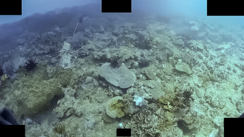
For instance, as part of a range of annual client surveys in the Indo Pacific region, we undertake comprehensive monitoring of the benthic habitat, encompassing sediment, bioturbation, rock cover, and species of hard coral, soft coral, algae, hydroids, gorgonians, and other invertebrates. The survey captures biodiversity and biomass data across the entire benthic habitat, excluding free-swimming organisms. To ensure precise tracking, all data points are geo-referenced and linked to their exact locations in real time through a live survey feed. This advanced approach enables Geo Oceans to conduct a 1km transect over highly diverse habitats and generate a comprehensive and well-organised dataset within a remarkably short timeframe. In less than two hours in-water, we can collect and collate the necessary data. Subsequently, our in-house processing capabilities allow for swift and accurate data analysis, facilitating the creation of highly precise and high-resolution environmental habitat maps.
Our award-winning software has disrupted the field and remains one of the most powerful marine science data collection software packages available globally. With Go VisionsTM, you gain unparalleled insights into marine ecosystems, empowering you to make informed decisions and drive conservation efforts.
Ready to dive into the world of Go VisionsTM? Get in touch with us to learn more about how our software can revolutionise your marine science projects and unlock the hidden potential of marine data.


